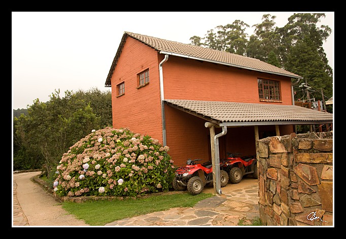
| Kdybychom měli víc času - můžeme jezdit na čtyřkolkách, rybařit nebo se potloukat po okolií Dračích hor. GPS ukazuje nadmořskou výšku 1668 m.n.m., ale je zatačeno - toho využiju zítra ráno. |
|
| 3 GPS 05. 03. 2010 15:33:22, JAR - Misty Mountain, 1/320 sec, f 5.6, ISO 400 , 17 mm, Blesk No Flash |
Cesta
2010/03 brezen/05b Misty Mountain I/20100305-058.jpgContains Exchangeable Image File Format (EXIF) Information
Main Image Information
| Image Width | 682 pixels |
| Image Length | 472 pixels |
| Compression | Uncompressed |
| Photometric Interpretation | RGB (Red Green Blue) |
| Make (Manufacturer) | Canon |
| Model | Canon EOS 40D |
| X Resolution | 1207959552/16777216 (72) pixels per 'Resolution Unit' |
| Y Resolution | 1207959552/16777216 (72) pixels per 'Resolution Unit' |
| Planar Configuration | Chunky Format |
| Resolution Unit | Inches |
| Date and Time | 2010:03:30 08:29:41 (Format: YYYY:MM:DD HH:mm:SS) |
| YCbCr Positioning | Chrominance components Centred in relation to luminance components |
EXIF Image File Directory (IFD) contents
| Exposure Time | 1/320 (0.003125) seconds |
| Aperture F Number | 56/10 (5.6) |
| Exposure Program | Aperture priority |
| ISO Speed Ratings | 400 |
| Exif Version | 0221 |
| Date and Time of Original | 2010:03:05 15:33:22 |
| Date and Time when Digitized | 2010:03:05 15:33:22 |
| APEX Shutter Speed Value (Tv) | 8321928/1000000 (8.321928) |
| APEX Aperture Value (Av) | 4970854/1000000 (4.970854) |
| APEX Exposure Bias Value (Exposure Compensation) | -1/3 (-0.33333333333333) EV |
| Metering Mode | Spot |
| Flash | Flash did not fire, compulsory flash suppression mode |
| FocalLength | 17/1 (17) mm |
| Sub Second Time of Original | 00 |
| Sub Second Time when Digitized | 00 |
| Focal Plane X Resolution | 3888000/876 (4438.3561643836) pixels per 'Focal Plane Resolution Unit' |
| Focal Plane Y Resolution | 2592000/583 (4445.9691252144) pixels per 'Focal Plane Resolution Unit' |
| Focal Plane Resolution Unit | Inches |
| Special Processing (Custom Rendered) | Normal process |
| Exposure Mode | Auto exposure |
| White Balance | Manual white balance |
| Scene Capture Type | Standard |
| Pixel X Dimension | 682 pixels |
| Pixel Y Dimension | 472 pixels |
| Colour Space | Uncalibrated |
| Components Configuration | Component 1: Y (Luminance) Component 2: Cb (Chroma minus Blue) Component 3: Cr (Chroma minus Red) Component 4: Does not exist |
| User Comment |
GPS Info Image File Directory (IFD) contents
| North or South Latitude | S |
| Latitude | 25/1 (25), 1053533/100000 (10.53533), 0/0 (Degrees Minutes Seconds North or South) |
| East or West Longitude | E |
| Longitude | 30/1 (30), 3963252/100000 (39.63252), 0/0 (Degrees Minutes Seconds East or West) |
| Altitude Reference | Sea Level |
| Altitude | 1659370/1000 (1659.37) Metres with respect to Altitude Reference |
Contains Extensible Metadata Platform (XMP) / Resource Description Framework (RDF) Information
Dublin Core Metadata Initiative RDF Segment
| Creator(s) (Authors): | Ordered List: Ing. Daniel Žingor |
| Rights Statement: | List of Alternates: © Daniel Žingor |
| Description (Caption): | List of Alternates: Kdybychom měli víc času - můžeme jezdit na čtyřkolkách, rybařit nebo se potloukat po okolií Dračích hor. GPS ukazuje nadmořskou výšku 1668 m.n.m., ale je zatačeno - toho využiju zítra ráno. |
| Subject and Keywords: | Unordered List: Architektura Reportáž Web |
XMP - embedded EXIF Segment
| Exif Version: | 0221 |
| Exposure Time: | 1/320 |
| Shutter Speed Value: | 8321928/1000000 |
| F Number: | 56/10 |
| Aperture Value: | 4970854/1000000 |
| Exposure Program: | 3 |
| Date & Time of Original: | 2010-03-05T15:33:22.00+01:00 |
| Date & Time Digitized: | 2010-03-05T15:33:22.00+01:00 |
| Exposure Bias Value: | -1/3 |
| Metering Mode: | 3 |
| Focal Length: | 17/1 |
| Custom Rendered: | 0 |
| Exposure Mode: | 0 |
| White Balance: | 1 |
| Scene Capture Type: | 0 |
| Focal Plane X Resolution: | 3888000/876 |
| Focal Plane Y Resolution: | 2592000/583 |
| Focal Plane Resolution Unit: | 2 |
| ISO Speed Ratings: | Ordered List: 400 |
| Flash: | Fired = False Return = 0 Mode = 2 Function = False Red Eye Mode = False |
| Pixel X Dimension: | 3888 |
| Pixel Y Dimension: | 2592 |
| GPS Longitude: | 30,39.632519E |
| GPS Latitude: | 25,10.535330S |
| GPS Altitude: | 1659370/1000 |
| GPS Altitude Reference: | 0 |
XMP - embedded TIFF Segment
| Make: | Canon |
| Model: | Canon EOS 40D |
| Image Width: | 3888 |
| Image Length: | 2592 |
| Samples Per Pixel: | 3 |
| Bits Per Sample: | Ordered List: 16 16 16 |
| Photometric Interpretation: | 2 |
XMP Basic Segment
| Resource Last Modify Date: | 2010-03-05T21:22:46+01:00 |
| Original Creation Date: | 2010-03-05T15:33:22.00+01:00 |
| Unknown field xap:Rating: | 3 |
| Unknown field xap:Label: | Green |
Unknown RDF Segment 'aux'
| Unknown field aux:Lens: | 17.00 - 50.00 mm |
| Unknown field aux:Firmware: | Firmware Version 1.0.3 |
Photoshop RDF Segment
| Unknown field photoshop:LegacyIPTCDigest: | EA20940AFBF52D322CB867DF2CB70E1C |
Unknown RDF Segment 'znr'
| Unknown field znr:RawDevelopSettings: | UEsDBBQAAAAIANWqZTyGEq+PvAIAAF4JAAAMAAAAc2V0dGluZ3MueG1sbZbNbtswDMfvA/Yma+sk TbMVhYBiuw/YuRdFZmKhsmRQcrr01XbYI+0VJtvUp5uT+OOflEXRdP79+fv0jm+PLVxAmYF9/jSb zwqBt9fnYVASWrZ5uvuAktaiGLjr2I/Hl9a8jj1od335eUT+/np92Tab5qbZ3TT7ednsmr1ff739 /mu75AzRlIyjkycu3EkqB8hIVFHSKnnunGXNoiErPFTHW/MWncEkrzDaIbcuuKMd/IqjdNfoJpO8 DvoBkLsRgT0cdvtFlNOQhvc5DdlKGpJK7djNgXJNRpZkMrPozGunJNxJo5mvLh02MVJdpL8OLSBp IiFFN8bnm5ZE344B+hWxk8GeO7ZbOFnka6E3lksRoqId664M2oGLVIxEQn6pwDcitRxZ5Bttbx2C PvuGeaAMOUsy5K0cLdvcbpOMWBK5DsF2RrWhzwqWdGrsjVbX8EwZIQ38HoTpB9bchvoGQgKNPiKc eTGix5cgeSYjtTAOGmzexARCucXAqNAibuUbWdvpWkJYAqRA47iD+WFJQiTcEpoBQbhF4X9f4mJT L+gWQ0TsA+vmtzq0AZmphQS0mvfAYhcFULzbLtzFffGSu+qK6O1eqWte5D4q0K2V78AORfLEy+xr /cpR5R+xlf5I08TaVVtkrnqXD6I+8hV7+YEA2k4j6n6fb5R4uctav3IU+eHCtsWFR1zmXekSD91p NIgRL+Hmk12MiE6eHMsnxAxIckZ+Rf/9CeUJduY+I4Bm+29JsJBM4qvp5+EmKWYQBWYc/Dts7DSi oyiHudJPx1yThuVszicoBAtZaZZTNrWwOrzHaRLkWVfzYaapwrl2VfeZaiMt+FKOYvmiZAGVq9gh Dphih3rs0IH0BdDW2TNcqH2zIx/QTJ+BMqDw5DFdi+Ufg4pW2uqPQo1z9dQkVnAFhThRr70r/0v9 B1BLAQIAABQAAAAIANWqZTyGEq+PvAIAAF4JAAAMAAAAAAAAAAEAIAAAAAAAAABzZXR0aW5ncy54 bWxQSwUGAAAAAAEAAQA6AAAA5gIAAAAA |
Unknown RDF Segment 'Iptc4xmpCore'
| Unknown field Iptc4xmpCore:Location: | JAR - Misty Mountain |
